


In case you missed it, SkyGrid just launched the first all-in-one drone app. What does that mean exactly? It means pilots can manage their entire drone workflow from airspace exploration and authorization… to flight planning and execution… to real-time insights… all within SkyGrid Flight Control™.
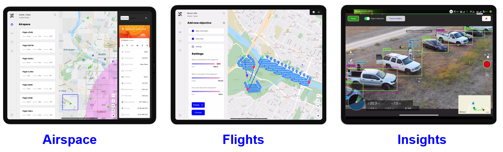
We recognized the challenge many drone operators are facing today by using several different tools to check airspace, get LAANC, plan flights, and safely execute them. It’s a cumbersome process that requires too many manual workflows and can lead to disconnected information as you switch between different applications.
We set out to solve this challenge by automating every phase of flight in one drone app. SkyGrid Flight Control automates flight authorization, planning, and execution to radically simplify your operations.
And we’re the only drone app built on artificial intelligence and blockchain technologies. Our AI computer vision enables real-time object detection while our patented blockchain system provides enhanced data privacy of all pilot, flight, and drone data stored within the app.
Learn more about the app experience in our latest video:
We’ll have more insights to share from our product experts in the coming weeks so stay tuned!
In the meantime, you can get started today by downloading SkyGrid Flight Control for free in the iPad App Store. You can also check out our advanced enterprise features, such as geofencing, custom object detection, and multi-drone missions, for more complex drone operations.
Happy flying!
Ali