
Advanced Air Mobility (AAM) aircraft will fly lower, slower, and closer to obstacles than any commercial aircraft before them. The weather data the industry relies on today wasn’t built for that, and the gap has to close before operations can scale.
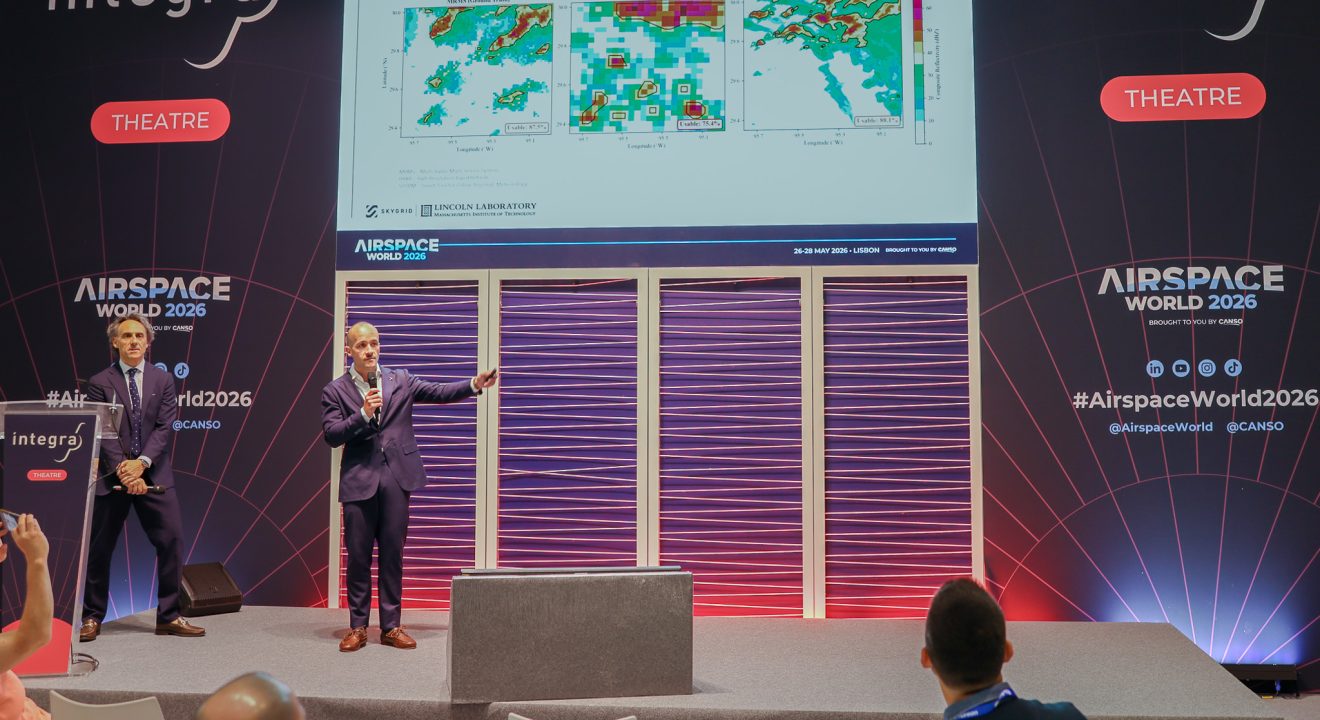
At Airspace World 2026, Jordan Cohen, R&D Lead at SkyGrid, and Gabriele Enea, Assistant Group Leader at MIT Lincoln Laboratory, presented joint research on the role of weather in AAM operations. Low-altitude weather poses unique challenges for AAM, but higher-resolution forecasting can close the operational gap, benefit traditional aviation, and inform future policy.
Weather as an Operational Challenge for AAM
Weather has a significant role in AAM operations that goes beyond what traditional aviation typically encounters. Low-altitude airspace is highly dynamic, with small-scale turbulent features driven by terrain and urban structures. Convection and storms, wind shear, updrafts and downdrafts, urban canyon effects, and reduced visibility all pose high risks at the altitudes AAM aircraft will operate. AAM aircraft like eVTOLs have a lower tolerance for these conditions than large carrier aircraft, making accurate, high-resolution weather data a crucial requirement for safe and scalable operations.
Improving the detection, prediction, and reporting of weather is also a primary component of the second pillar of the U.S. AAM National Strategy. Existing forecasting models were not built with AAM in mind, and that needs to change before operations can scale.
STORM: A Micro-Resolution Weather Forecasting Model
MIT Lincoln Lab’s STORM (Smart Tool for Online Regional Meteorology) model is a micro-resolution weather forecasting model designed to address gaps in low-altitude weather forecasting for AAM. STORM requires minimal hardware deployment and offers fully customizable forecasts across spatial resolutions of 100m, 250m, and 500m, with time resolutions as short as five minutes and forecast horizons of three to eighteen hours ahead. The High Resolution Rapid Refresh (HRRR) model sets boundary conditions for STORM hourly, and future updates will assimilate aircraft-derived and real-time sensor observations from MDCRS, LIDAR, and other weather sensing systems.
Legacy forecasting models like HRRR provide a single snapshot of conditions per hour, which limits how precisely operators and Air Navigation Service Providers can anticipate capacity changes. STORM’s finer resolution enables far more dynamic operational planning, the kind needed to support high-tempo AAM schedules.
Measuring the Operational Benefits
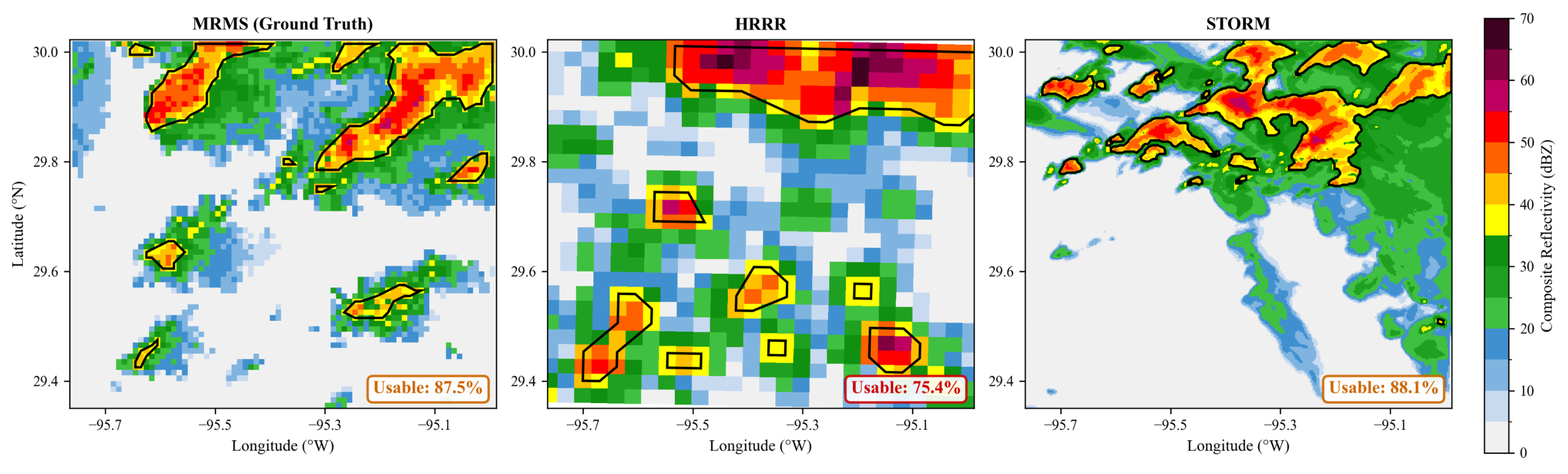
To evaluate the benefits of higher-resolution forecasting, SkyGrid developed a testbed that ingests weather information from three sources: MRMS ground truth data, HRRR, and STORM. The testbed then runs the data through two decision support tools: Airspace Hazard Assessment and Flight Plan Evaluation. The outputs are compared through operational metrics across all three weather sources.
The first measure of weather’s operational impact is the airspace hazard assessment, evaluating how accurately and precisely different forecasting models predict usable airspace. STORM and the ground truth reached close agreement at around 88% usable airspace, while HRRR was nearly 20% off. The coarser resolution of legacy models also produced more false hazard regions, flagging airspace as unsafe when conditions were actually clear.
The second measure is flight plan validity, evaluating how forecasted convective weather conflicts with individual routes. By deploying a 4D conflict detection technique that compares flight plans with hazardous weather volumes, STORM and MRMS showed strong agreement in identifying conflicting routes, while HRRR flagged certain routes as safe that were actually in conflict with hazardous conditions. STORM’s higher resolution translates to fewer unnecessary penalties on safe flight plans, improving both efficiency and safety.
The third measure is route status change, evaluating how weather conditions affect open and closed route status over time as a proxy for scheduling. STORM’s higher temporal resolution enabled a more granular picture of route status across the forecasts.
Policy and Regulatory Implications
This work aims to drive the development of future weather standards for AAM. Existing standards, including ASTM F3673-23, do not cover weather data requirements based on AAM operational limitations, nor do they establish performance standards for weather forecasts used in AAM operations. Establishing real requirements without extensive operational data from aircraft that aren’t yet flying at scale is difficult, which is exactly why this collaboration matters.
By combining SkyGrid’s decision support systems with STORM and MIT Lincoln Lab’s modeling capabilities, the work is laying the groundwork for operationally driven standards, with applications that extend to airline operations centers, in-flight turbulence avoidance, and trajectory-based operations across traditional aviation.