


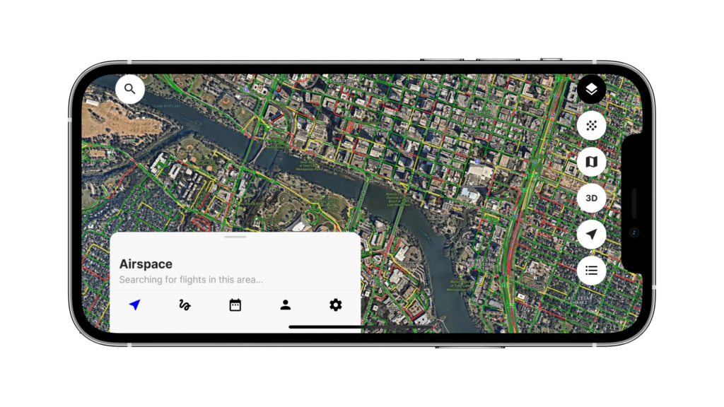
Navigating low-altitude airspace is complex. Drone operators need to monitor weather changes, avoid buildings and construction cranes, factor in risks on the ground and comply with shifting regulatory dynamics. That’s why we created your go-to airspace map for safe drone operations.
Our free, SkyGrid Flight Control app provides a robust map of airspace, weather, regulatory, and location data, such as airspace traffic, hyper-local weather, flight restrictions, population density, and more, which is critical to help drone operators minimize risks in the airspace and more intelligently manage unmanned flights. Did we mention it’s easy to use? All the airspace data provided in our app makes it easy for drone operators to execute safe and compliant missions.
Check out the quick overview from our team and read on for more details:
Airspace and Weather Intelligence
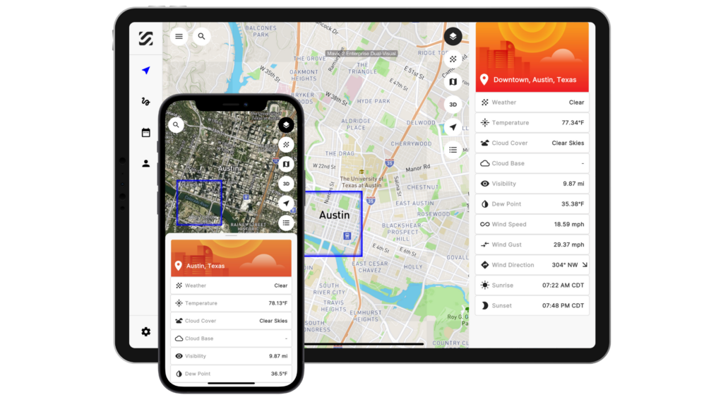
Our airspace intelligence includes advanced weather data, such as precipitation, temperature, wind direction and speed, cloud cover, visibility, and more.
The hyper-local weather data is updated every 60 seconds and detailed to the 500-meter radius. When you consider how quickly weather patterns can change, more detailed, real-time data becomes critical to minimize risks in the airspace, mainly because these factors can impact the flight path, battery life, and overall success of the mission. Additionally, our map layers have layer legends, enabling drone operators to quickly understand and translate the ground intelligence and regulations in the operators’ flight area before take-off to stay compliant.
As shown below, pilots can select a tile on our airspace map for an overview of the hyper-local weather details.
Location Insights and Ground Intelligence
Our location insights include roadway traffic, population density, local buildings, and obstacles.
The traffic layer displays traffic density on roadways to help drone operators avoid flying over potentially dangerous situations like congested areas that may pose a risk to vehicles and people on the ground. As you’d expect, the green roads represent light traffic whereas the red roads represent heavy traffic. Operators can use this tool to understand what time of the day has the least amount of traffic and schedule their missions accordingly. Additionally, the population density map layer helps visualize a heavily populated area when operating a drone.
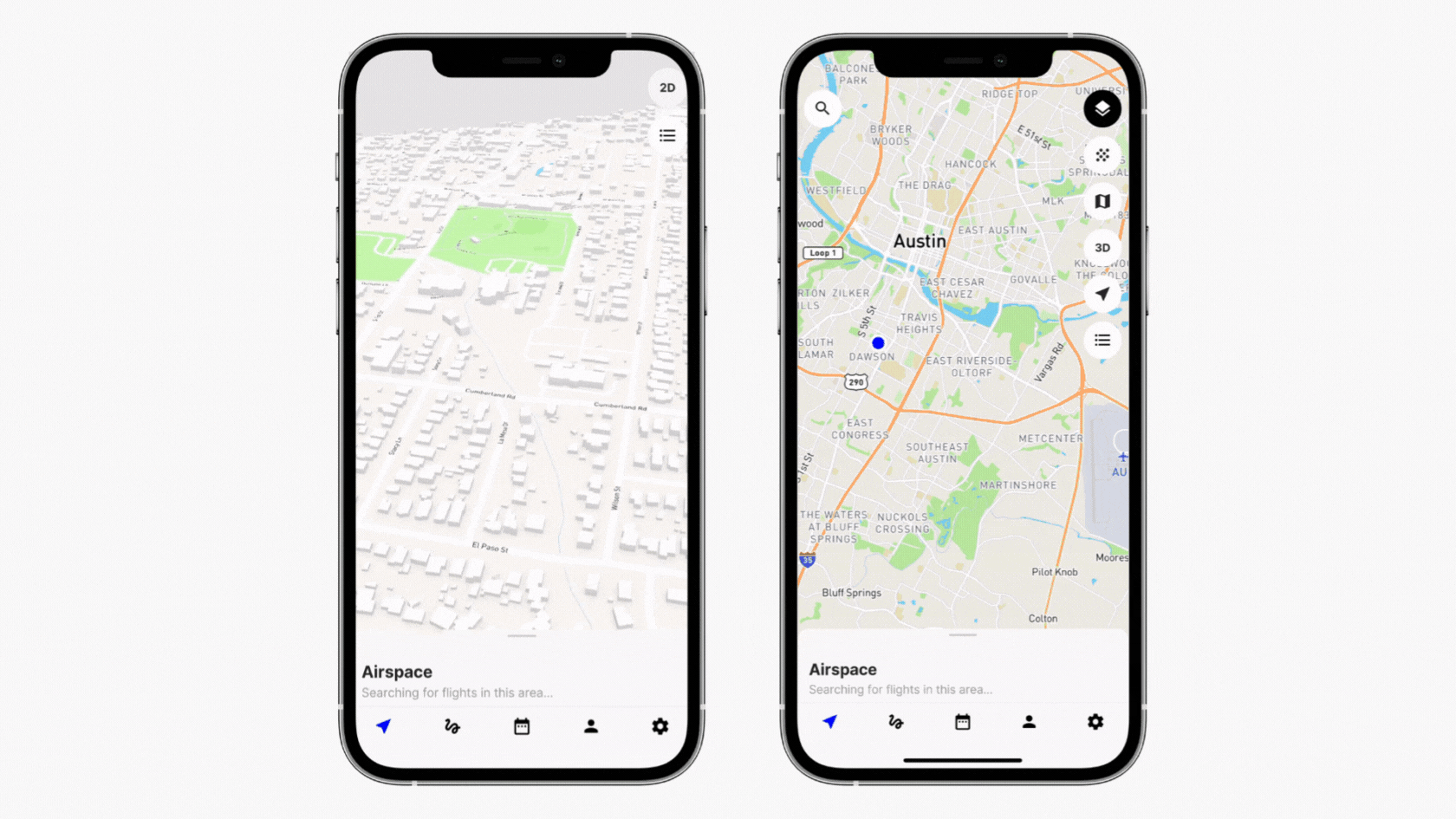
Drone pilots can evaluate the airspace with a variety of map styles, such as satellite view or in 3D, making it easier to plan inspections and other object-centric flights. When reviewing their mission plan, a different point of view is also helpful for drone pilots to ensure there are no buildings or infrastructures too close to the flight path.
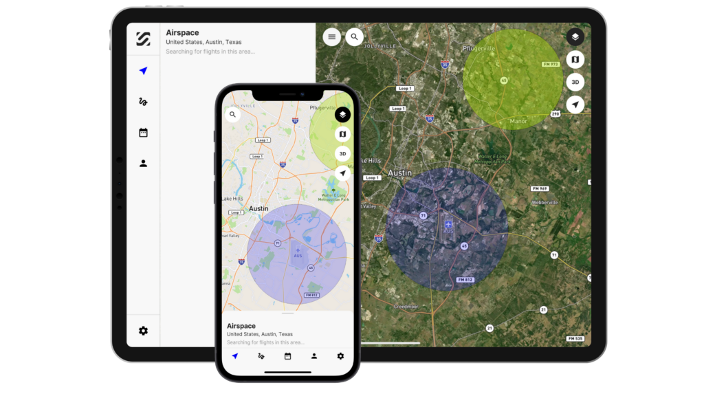
Regulatory Data and Advisories
Our regulatory data includes airspace classes and advisories from the FAA, such as National Security UAS Flight Restrictions. We also display the FAA’s UAS Facility Maps that show the pre-approved ceilings in controlled airspace where LAANC approval is required.
For example, the area in purple shows Class C airspace where auto-approval is available up to the pre-approved altitude displayed in the grid, and the area in green indicates Class D airspace.
For enterprises, SkyGrid also offers advanced data layers based on the unique needs of the mission. These data layers can include manned air traffic, foot traffic, radar-detected objects, and other data layers customized to the specific enterprise. To further simplify drone operations, enterprises can also leverage our AI technology to automatically plan, execute, and adapt flights as conditions change.